Insightful Geodata Processing
The amount of digital geographic data that dredging projects generate can seem quite extensive at times. Furthermore, data often requires geographic data processing before interpreting and being able to use it.
That is why we believe in using Geographic Information Systems (GIS) when needed, considering its importance. Although these large geographic datasets usually require much effort, i2D has already pre-invested in tools to deliver more quickly.

Many large geographic datasets could benefit dredging projects, such as:
- Bathymetric surveys
- Dredging designs
- Geotechnical and geophysical investigations
- Satellite images
- Performance monitoring data
To use such datasets, we have developed flexible ready-made tools that read and process large datasets using coordinate and data transformation methods. These tools easily combine several sources of information as well as present multiple data sources into a single graph. We can potentially provide ground‑breaking insights into certain dredging projects, from conception to execution and also claims. These tools can provide insights into:
- Indisputable evidence on events
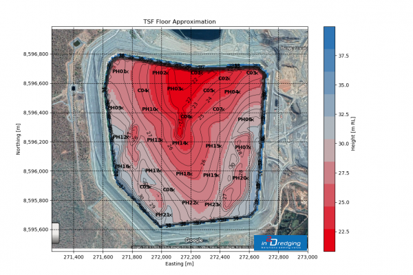
- Soil quantity and quality, including the likely probability of certain soil conditions being present at a site
- Data quality and coverage
- Correlations between physical parameters and confidence levels
- Operational performance
- Habitat mapping
In addition, i2D has a large network of geotechnical, geophysical and bathymetric surveyors able to acquire and deliver high-quality datasets on schedule.
Bathymetric Surveys
Bathymetric survey data is essential in order to estimate and monitor dredging works underwater. i2D’s hydrographic surveying solutions include:
- Pre-dredging and post-dredging bathymetric surveys and mapping
- Volume calculations and visualisation
- Review, interpretation and verification of survey data
- Global Positioning System (GPS), Differential GPS (DGPS) and underwater positioning system surveys
- Single beam and multibeam bathymetry data processing
- Topographic and routing surveys
- Cross and long profiles
i2D can also develop survey specifications and provide client representation services. Moreover, i2D can combine bathymetric survey data with any other dataset, such as geophysical data or satellite images to simplify interpretation.
Geotechnical and Geophysical Investigations
Soil investigations are essential in reducing the risk of delays and cost blowouts on dredging projects. Professionals carry out in-depth geotechnical and geophysical investigations in order to characterise soils and determine soil volumes (https://www.pianc.org/publications/marcom/site-investigation-requirements-for-dredging-works). High quality soil data for the significant geotechnical parameters in combination with in-depth production estimates result in robust budgets and timely project delivery.
Dredging includes the unique science of destructive soil mechanics. This science identifies soil parameters that describe soil failure mechanisms during operations such as blasting, cutting, breaching and jetting. To avoid unnecessary soil investigations, i2D can specify the ones required to effectively determine production estimates. These estimates are key to reducing the risk and creation of budgets and schedules.
Dredging projects require both geophysical and geotechnical data due to the nature of these datasets. While geophysical data has high resolution and low confidence levels, geotechnical data has low resolution and high confidence levels. Combining these two datasets for soil modelling increases the resolution and confidence levels in the soil data.
i2D can help you with geotechnical and geophysical investigations by:
- Planning and specifying soil investigations as part of the overarching dredging project
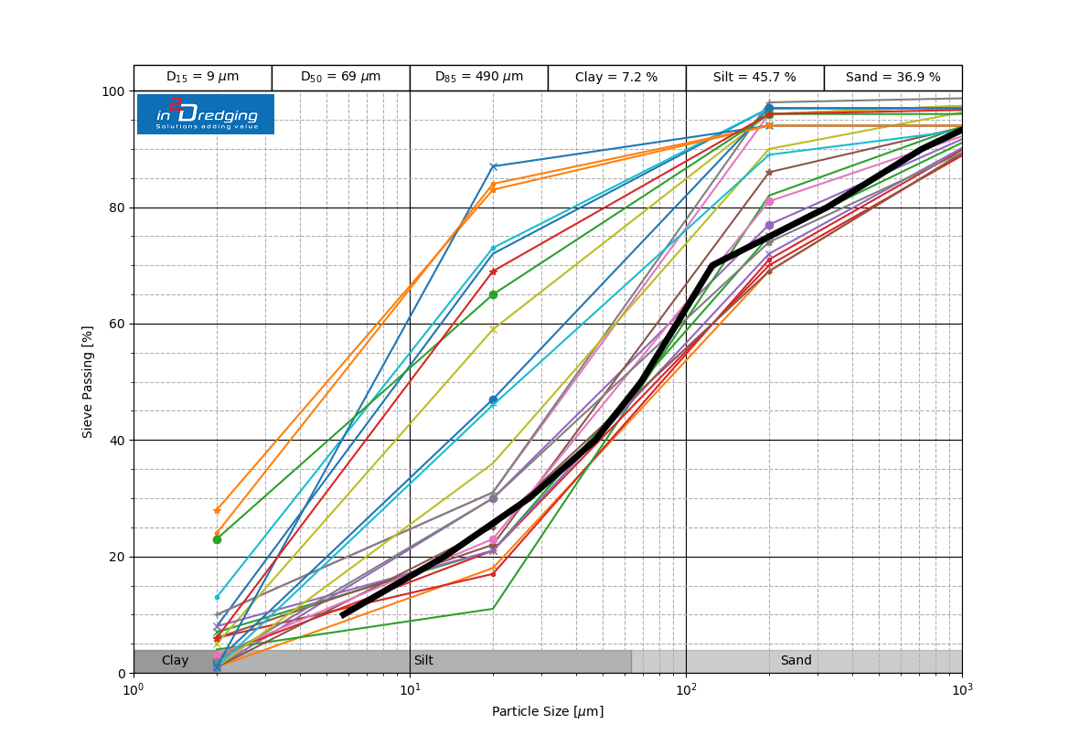
- Characterising, modelling, interpreting, verifying and reviewing soil data
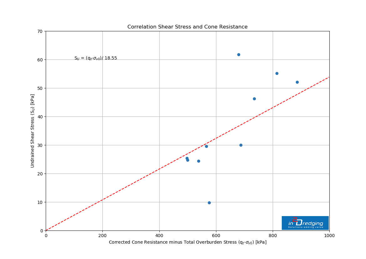
- Correlating soil parameters to increase confidence levels in existing soil data
- Processing and visualising soil data in combination with bathymetric surveys, etc.
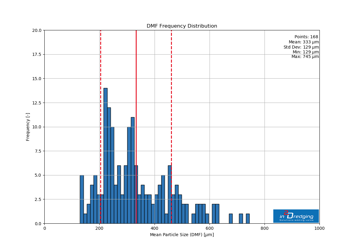
- Create frequency distributions, fit suitable distribution and determine probabilities.
- Monitoring actual and planned performance against soil models
For these investigations, i2D’s main goal is to process soil data that can provide enough confidence in dredging projects’ budgets and schedules and get the most out of expensive soil data.


